Republic of Ireland electoral divisions#
import os
from datetime import datetime, timezone
from zipfile import ZipFile
import matplotlib.pyplot as plt
import geopandas as gpd
import pooch
URL = (
    "https://opendata.arcgis.com/api/v3/datasets/"
    "429c839036934413bb740bea190f2596_0/downloads/data?"
    "format=shp&spatialRefId=2157&where=1%3D1"
)

KNOWN_HASH = None
FILE_NAME = "electoral-divisions-2019.zip"
SUB_DIR = os.path.join("data", "boundaries", "OSi")
DATA_FILE = os.path.join(SUB_DIR, FILE_NAME)
os.makedirs(SUB_DIR, exist_ok=True)
# download data if necessary
if not os.path.isfile(os.path.join(SUB_DIR, FILE_NAME)):
    pooch.retrieve(
        url=URL, known_hash=KNOWN_HASH, fname=FILE_NAME, path=SUB_DIR
    )

    with open(
        os.path.join(SUB_DIR, f"{FILE_NAME[:-4]}.txt"), "w", encoding="utf-8"
    ) as outfile:
        outfile.write(
            f"Data downloaded on: {datetime.now(tz=timezone.utc)}\n"
            f"Download URL: {URL}"
        )
Downloading data from 'https://opendata.arcgis.com/api/v3/datasets/429c839036934413bb740bea190f2596_0/downloads/data?format=shp&spatialRefId=2157&where=1%3D1' to file '/run/media/nms/Backup/Documents/Git/ClimAg/ClimAg/data/OSi/electoral-divisions-2019.zip'.
SHA256 hash of downloaded file: 6dabe10b8e36b256cc981e6967abf7e80d3caf77a957cf2d3a7a9d0dc24e0a3b
Use this value as the 'known_hash' argument of 'pooch.retrieve' to ensure that the file hasn't changed if it is downloaded again in the future.
ZipFile(DATA_FILE).namelist()
['Electoral_Divisions_-_OSi_National_Statutory_Boundaries_-_2019.shp',
 'Electoral_Divisions_-_OSi_National_Statutory_Boundaries_-_2019.shx',
 'Electoral_Divisions_-_OSi_National_Statutory_Boundaries_-_2019.dbf',
 'Electoral_Divisions_-_OSi_National_Statutory_Boundaries_-_2019.cpg',
 'Electoral_Divisions_-_OSi_National_Statutory_Boundaries_-_2019.prj',
 'Electoral_Divisions_-_OSi_National_Statutory_Boundaries_-_2019.xml']
data = gpd.read_file(
    f"zip://{DATA_FILE}!"
    "Electoral_Divisions_-_OSi_National_Statutory_Boundaries_-_2019.shp"
)
data.head()
| ED_ID | ENGLISH | GAEILGE | CONTAE | COUNTY | PROVINCE | GUID | CENTROID_X | CENTROID_Y | AREA | ESRI_OID | Shape__Are | Shape__Len | geometry | |
|---|---|---|---|---|---|---|---|---|---|---|---|---|---|---|
| 0 | 267160 | TURNAPIN | Turnapain | Baile Átha Cliath | DUBLIN | Leinster | 2ae19629-1cea-13a3-e055-000000000001 | 717365.57 | 740807.88 | 943505.13 | 1 | 9.435051e+05 | 4732.251966 | POLYGON ((717716.712 741601.510, 717759.461 74... |
| 1 | 27045 | DRUMLUMMAN | Droim Lomáin | An Cabhán | CAVAN | Ulster | 2ae19629-1caa-13a3-e055-000000000001 | 638130.82 | 789588.69 | 17617760.82 | 2 | 1.761776e+07 | 21762.101454 | POLYGON ((637756.185 787640.988, 637753.646 78... |
| 2 | 117019 | CASTLEFORE | Baile Choille Fóir | Liatroim | LEITRIM | Connacht | 2ae19629-171c-13a3-e055-000000000001 | 606853.02 | 809670.32 | 14080012.63 | 3 | 1.408001e+07 | 21907.071044 | POLYGON ((608196.069 807618.950, 608244.536 80... |
| 3 | 37135 | RAHONA | Ráth Úna | An Clár | CLARE | Munster | 2ae19629-1fec-13a3-e055-000000000001 | 481634.87 | 649839.86 | 24664562.56 | 4 | 2.466456e+07 | 35830.867808 | POLYGON ((484212.068 651795.629, 484231.866 65... |
| 4 | 167021 | CROSSAKEEL | Crosa Caoil | An Mhí | MEATH | Leinster | 2ae19629-1861-13a3-e055-000000000001 | 662161.01 | 774125.96 | 20159197.51 | 5 | 2.015920e+07 | 34415.329703 | POLYGON ((663308.409 776111.796, 663305.294 77... |
data.crs
<Derived Projected CRS: EPSG:2157>
Name: IRENET95 / Irish Transverse Mercator
Axis Info [cartesian]:
- E[east]: Easting (metre)
- N[north]: Northing (metre)
Area of Use:
- name: Ireland - onshore. United Kingdom (UK) - Northern Ireland (Ulster) - onshore.
- bounds: (-10.56, 51.39, -5.34, 55.43)
Coordinate Operation:
- name: Irish Transverse Mercator
- method: Transverse Mercator
Datum: IRENET95
- Ellipsoid: GRS 1980
- Prime Meridian: Greenwich
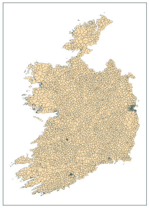
base = data.plot(color="navajowhite", figsize=(7.5, 7.5))
data.boundary.plot(ax=base, color="darkslategrey", linewidth=0.2)
plt.tick_params(labelbottom=False, labelleft=False)
plt.tight_layout()
plt.show()
data.to_file(
    os.path.join("data", "boundaries", "boundaries_all.gpkg"),
    layer="OSi_IE_electoral_divisions_2019",
)