Northern Ireland electoral wards#
Downloaded from ONS Geography
import os
from datetime import datetime, timezone
from zipfile import ZipFile
import matplotlib.pyplot as plt
import geopandas as gpd
import pooch
import climag.climag as cplt
FILE_NAME = "wards-uk-12-2022.zip"
URL = (
    "https://opendata.arcgis.com/api/v3/datasets/"
    "a2c204fedefe4120ac93f062c647bdcb_0/downloads/data?"
    "format=shp&spatialRefId=27700&where=1%3D1"
)
KNOWN_HASH = None
SUB_DIR = os.path.join("data", "boundaries", "ONS")
DATA_FILE = os.path.join(SUB_DIR, FILE_NAME)
os.makedirs(SUB_DIR, exist_ok=True)
# download data if necessary
if not os.path.isfile(os.path.join(SUB_DIR, FILE_NAME)):
    pooch.retrieve(
        url=URL, known_hash=KNOWN_HASH, fname=FILE_NAME, path=SUB_DIR
    )

    with open(
        os.path.join(SUB_DIR, f"{FILE_NAME[:-4]}.txt"), "w", encoding="utf-8"
    ) as outfile:
        outfile.write(
            f"Data downloaded on: {datetime.now(tz=timezone.utc)}\n"
            f"Download URL: {URL}"
        )
Downloading data from 'https://opendata.arcgis.com/api/v3/datasets/a2c204fedefe4120ac93f062c647bdcb_0/downloads/data?format=shp&spatialRefId=27700&where=1%3D1' to file '/run/media/nms/Backup/Documents/Git/ClimAg/ClimAg/data/boundaries/ONS/wards-uk-12-2022.zip'.
SHA256 hash of downloaded file: 3c39befbab09220c372282e986c2ba98f98e583d3a619997bd21017967d8abcd
Use this value as the 'known_hash' argument of 'pooch.retrieve' to ensure that the file hasn't changed if it is downloaded again in the future.
ZipFile(DATA_FILE).namelist()
['WD_DEC_2022_UK_BFC.shp',
 'WD_DEC_2022_UK_BFC.shx',
 'WD_DEC_2022_UK_BFC.dbf',
 'WD_DEC_2022_UK_BFC.cpg',
 'WD_DEC_2022_UK_BFC.prj',
 'Wards_(December_2022)_Boundaries_UK_BFC.xml']
data = gpd.read_file(f"zip://{DATA_FILE}!WD_DEC_2022_UK_BFC.shp")
data.head()
| OBJECTID | WD22CD | WD22NM | WD22NMW | LAD22CD | LAD22NM | BNG_E | BNG_N | LONG | LAT | GlobalID | SHAPE_Leng | SHAPE_Area | geometry | |
|---|---|---|---|---|---|---|---|---|---|---|---|---|---|---|
| 0 | 1 | E05000650 | Astley Bridge | None | E08000001 | Bolton | 370670 | 412906 | -2.44479 | 53.611889 | {FB9555E0-FE42-4ED7-9525-83D2EF94B123} | 15040.493581 | 6.598171e+06 | POLYGON ((370294.199 414678.699, 370300.399 41... |
| 1 | 2 | E05000651 | Bradshaw | None | E08000001 | Bolton | 374590 | 413058 | -2.38555 | 53.613461 | {25DBEFBC-459D-4966-B69B-61E110806F46} | 16910.442350 | 9.273577e+06 | POLYGON ((375025.397 414992.099, 375032.702 41... |
| 2 | 3 | E05000652 | Breightmet | None | E08000001 | Bolton | 374437 | 409641 | -2.38758 | 53.582741 | {8FA89CD8-E6AC-4A50-90BD-CC5A5FD83F3A} | 10083.153424 | 3.709192e+06 | POLYGON ((375150.804 410809.796, 375151.101 41... |
| 3 | 4 | E05000653 | Bromley Cross | None | E08000001 | Bolton | 372113 | 414150 | -2.42309 | 53.623150 | {3CA0E3AB-5AE6-4699-9438-FEA1E93D2FC3} | 16325.175894 | 6.976807e+06 | POLYGON ((373286.299 414364.499, 373289.267 41... |
| 4 | 5 | E05000654 | Crompton | None | E08000001 | Bolton | 371741 | 410493 | -2.42838 | 53.590260 | {538DB093-64E4-4FFD-B942-DB4D2401F099} | 12524.442409 | 3.495937e+06 | POLYGON ((373168.601 411597.801, 373160.900 41... |
# filter NI data
data = data[data["WD22CD"].str.contains("N")]
data.head()
| OBJECTID | WD22CD | WD22NM | WD22NMW | LAD22CD | LAD22NM | BNG_E | BNG_N | LONG | LAT | GlobalID | SHAPE_Leng | SHAPE_Area | geometry | |
|---|---|---|---|---|---|---|---|---|---|---|---|---|---|---|
| 6904 | 6905 | N08000101 | Abbey | None | N09000001 | Antrim and Newtownabbey | 148871 | 538433 | -5.89564 | 54.677608 | {5BDA2CD0-D7CB-4D6B-90EB-75F8A1FFD7A4} | 5291.934708 | 9.102273e+05 | POLYGON ((149340.309 538414.993, 149336.059 53... |
| 6905 | 6906 | N08000102 | Aldergrove | None | N09000001 | Antrim and Newtownabbey | 123312 | 535417 | -6.28810 | 54.637211 | {EF80E5AC-3B27-4D56-9BB3-0CBFE94D7642} | 66396.070829 | 1.562231e+08 | POLYGON ((130108.925 542464.201, 130112.129 54... |
| 6906 | 6907 | N08000103 | Antrim Centre | None | N09000001 | Antrim and Newtownabbey | 126897 | 544127 | -6.24085 | 54.717220 | {2900E2DF-24DB-45B8-8266-663DDF1D3BDF} | 17140.311467 | 1.062755e+07 | POLYGON ((127653.044 545907.757, 127662.256 54... |
| 6907 | 6908 | N08000104 | Ballyclare East | None | N09000001 | Antrim and Newtownabbey | 142993 | 547438 | -5.99452 | 54.755379 | {ED83EA03-CE92-4D89-B5C4-BEB02CD9A528} | 8186.240587 | 1.828746e+06 | POLYGON ((142837.322 546770.920, 142836.083 54... |
| 6908 | 6909 | N08000105 | Ballyclare West | None | N09000001 | Antrim and Newtownabbey | 141887 | 547417 | -6.01165 | 54.754620 | {0835C4C3-E634-4DEC-B0BE-3A67BFF613C7} | 8307.724846 | 1.782133e+06 | POLYGON ((142746.868 548308.122, 142743.571 54... |
data.crs
<Derived Projected CRS: EPSG:27700>
Name: OSGB36 / British National Grid
Axis Info [cartesian]:
- E[east]: Easting (metre)
- N[north]: Northing (metre)
Area of Use:
- name: United Kingdom (UK) - offshore to boundary of UKCS within 49°45'N to 61°N and 9°W to 2°E; onshore Great Britain (England, Wales and Scotland). Isle of Man onshore.
- bounds: (-9.0, 49.75, 2.01, 61.01)
Coordinate Operation:
- name: British National Grid
- method: Transverse Mercator
Datum: Ordnance Survey of Great Britain 1936
- Ellipsoid: Airy 1830
- Prime Meridian: Greenwich
# reproject to Irish Transverse Mercator
data.to_crs(cplt.ITM_EPSG, inplace=True)
data.crs
<Derived Projected CRS: EPSG:2157>
Name: IRENET95 / Irish Transverse Mercator
Axis Info [cartesian]:
- E[east]: Easting (metre)
- N[north]: Northing (metre)
Area of Use:
- name: Ireland - onshore. United Kingdom (UK) - Northern Ireland (Ulster) - onshore.
- bounds: (-10.56, 51.39, -5.34, 55.43)
Coordinate Operation:
- name: Irish Transverse Mercator
- method: Transverse Mercator
Datum: IRENET95
- Ellipsoid: GRS 1980
- Prime Meridian: Greenwich
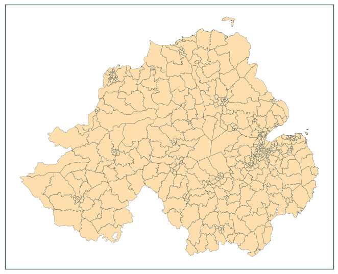
base = data.plot(color="navajowhite", figsize=(7, 7))
data.boundary.plot(ax=base, color="darkslategrey", linewidth=0.2)
plt.tick_params(labelbottom=False, labelleft=False)
plt.tight_layout()
plt.show()
data.to_file(
    os.path.join("data", "boundaries", "boundaries_all.gpkg"),
    layer="ONS_NI_wards_12_2022_2157",
)